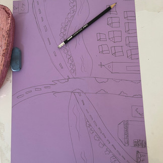
Grade 7 Geographers were introduced to the lesson urbanisation with a 'Scenario-Based Learning Concept.' It was a detailed mapping activity that engaged students to get well-versed with the consequences of urbanisation and helped them grasp the concept of cities throughout history and around the world.
Students learned how to use maps and other geographic representations, tools, and technologies to gather, process, and report information from a spatial standpoint during the game. The students were also able to analyse the geographical organisation of people, places, and environments on Earth's surface by using mental maps to organise knowledge about people, places, and habitats in a spatial context. They were able to comprehend the physical and human qualities of the location and the characteristics, distribution, and migration of the human population on the Earth's surface.

Grade 7 Geography student - As an introduction to the idea of urbanisation, we students were given scenarios in which they were required to plan their urban city in stages. We began with the year 1700s (Round 1) and concluded with the year 1850 (Round 20). Throughout the process, we learn how settlements evolve through time, how population impacts settlements, how technical advancement alters an area's landscape, how increased demand results in increased output and the birth of industries, and the critical role rivers play in settlements. Each round prescribed some increases and some decreases, and hence it needed to be done prudently to last until the 1850s. Following twenty scenario rounds, we conducted a geographic analysis. We analysed the type of settlement we began with and how we ended up, and the elements that drove the urban design. What environmental issues has the city encountered due to the changes? What problems may arise if the same design were taken into the twenty-first century, and how would they be resolved?


Comments